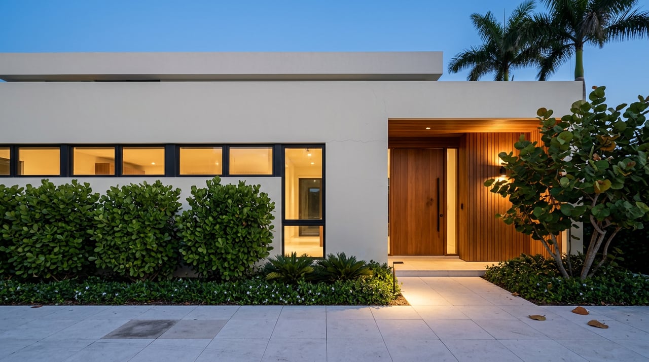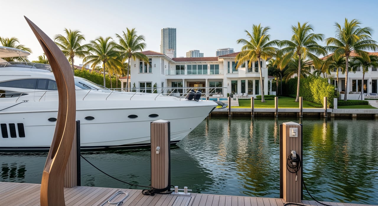
Dreaming of a Miami Beach home where your boat sits steps from your back door? The right property can deliver that lifestyle, but boat access in Miami-Dade is not one-size-fits-all. Water depth, bridge heights, speed zones, and permits shape what you can safely and legally do from your dock. This guide gives you the essentials to match a home to your boat and your cruising style so you can buy with confidence. Let’s dive in.
Bay vs. ocean access in Miami Beach
Biscayne Bay and ICW basics
If you plan to cruise to waterfront restaurants and marinas, you will likely spend most of your time on Biscayne Bay and the Intracoastal Waterway. Bay routes are relatively sheltered and shallower, which is ideal for day boating and quick trips. You still need to confirm usable depth at your dock at the lowest normal tide. Use official data from NOAA tidal predictions for your specific location.
Ocean access through inlets
Reaching the Atlantic from a bayfront home typically means transiting an inlet such as Government Cut or Haulover Inlet. Inlets can have strong currents, shoaling, and commercial traffic. Sea conditions change quickly, and not all small boats should attempt inlets without local knowledge. If regular offshore runs are your priority, plan for deeper water, larger channels, and a longer route.
Traffic and timing
Biscayne Bay is an active waterway with commercial vessels, tour boats, and seasonal recreational traffic. Expect slower transits during peak hours, especially near marinas and canals. Congestion increases the importance of solid docking skills and patience around no-wake areas.
Bridges and air draft: Will your boat fit?
Know your true air draft
Air draft is the highest fixed point on your boat above the waterline. Measure it accurately with antennas, towers, arches, and masts in their real-world position. Add a safety margin for waves and tide variation so you are not cutting it close under a fixed bridge.
Use official clearance data the right way
Bridge clearances on charts are tied to a specific reference, such as mean high water or mean lower low water. That matters because water level at the time you pass may be different. Confirm the datum, then adjust for the day’s tide using NOAA nautical charts and the local tide predictions. The U.S. Coast Guard and local authorities publish bridge details and schedules for movable spans when applicable.
Step-by-step route check
- List your boat’s air draft, length overall, beam, and draft.
- Trace the route from the property to your cruising grounds on official charts. Highlight every fixed bridge.
- Compare each bridge clearance to your air draft. If any are lower, that route is not feasible.
- When in doubt, call a local marina operator or municipal marine patrol to sanity-check clearances.
Fixed vs. movable bridges
Many Miami Beach causeways are fixed spans. Some regional bridges have openings with posted schedules, but you should not rely on openings for daily use unless you confirm operations with local authorities. If your routine route requires openings, build that wait time into your lifestyle assumptions.
Speed, no-wake, and environmental rules
Who sets and enforces the rules
Florida’s boating laws are enforced by the Florida Fish and Wildlife Conservation Commission, with additional local zones set and enforced by municipal marine units and county law enforcement. Review statewide requirements via the FWC boating regulations, and check local postings when you are on the water. The City of Miami Beach provides local resources and contacts for marine questions on its official website.
No-wake zones and your daily run
“No-wake” means operating at the slowest speed that maintains steerage and creates minimal wake. Expect posted no-wake or reduced-speed zones near marinas, canals, dock-lined shorelines, and popular recreation areas. Extended no-wake zones can add time to your route, but they also protect docks, moored vessels, and sensitive shorelines.
Seagrass, mangroves, and protected areas
Biscayne Bay includes protected seagrass beds and mangroves. Anchoring in seagrass, prop scarring, or trimming mangroves without authorization can lead to fines. Many shoreline activities below the mean high-water line require permits from the Florida Department of Environmental Protection. For guidance on coastal and aquatic resource permitting, review the FDEP site.
Docks, lifts, and permits in Miami Beach
Who regulates what
Private dock work typically crosses multiple agencies. The City of Miami Beach oversees local building, planning, and electrical scope. Miami-Dade County’s Regulatory and Economic Resources department handles environmental reviews, seawalls, and shoreline impacts. State-level approvals run through the Florida Department of Environmental Protection. Projects in navigable waters may also require federal review by the U.S. Army Corps of Engineers. Start with the City’s official portal, confirm county processes with Miami-Dade RER, consult FDEP, and check federal permit needs with the USACE Regulatory Program.
What activities need permits
- New docks, dock extensions, or reconstruction
- Boat lifts, davits, and piling work
- Seawall installation or repair
- Dredging or channel maintenance
- Utility lines or fuel lines over submerged lands
Timelines and expectations
Simple repairs or minor dock projects may be processed in weeks to a few months. Complex work such as dredging, work on sovereign submerged lands, or projects that affect seagrass can take many months and may require environmental studies or mitigation. Build time into your closing plan for permit approvals, engineering, and surveys.
Riparian rights and existing structures
Owning the upland parcel does not automatically allow filling or altering submerged sovereign lands. Confirm recorded riparian rights and easements, and verify that the current dock and lifts were properly permitted. Ask for copies of permits and any conditions, plus expiration dates.
Hurricanes, codes, and insurance
Coastal construction must meet current building codes and flood regulations, which can affect how you rebuild docks and seawalls after storms. Marine insurers may require certain construction standards or hurricane-safe features. Factor ongoing maintenance for pilings, seawalls, and corrosion into your annual budget.
Alternatives to private dockage
If your boat exceeds a property’s depth or length limits, look at marina slips, dry stack storage, or mooring fields. These options can be more practical for larger vessels or while you work through dock upgrades. A nearby marina slip can also serve as a contingency if permits or construction are delayed.
Your vessel-to-property compatibility checklist
Boat and site specs to confirm
- Length overall, beam, draft, and air draft
- Required linear dock length for safe mooring and maneuvering
- Minimum water depth at mean low water at the dock and along the approach
- Overhead obstructions and bridge clearances along your route
- Directional exposure to prevailing winds and boat traffic
Documents to request from the seller
- Copies of existing dock, lift, seawall, or dredge permits with conditions
- Current survey showing property lines, dock location, and riparian boundaries
- Recent depth soundings tied to a tide datum for the dock and approach channel
- Evidence of riparian rights or approvals for structures over submerged lands
- Any association or marina rules that affect dock use or guest mooring
Questions to ask local authorities and pros
- City permitting: Are the existing structures permitted, and what is the process for replacement or expansion?
- County environmental review: Are there seagrass or mangrove restrictions at this site, or any recent enforcement actions?
- FDEP and USACE: Would proposed dredging need individual permits or mitigation?
- Local marinas and captains: What are the real-world challenges with shoaling, tides, or seasonal traffic near the property?
- Licensed marine surveyor or coastal engineer: What is the structural condition of the seawall and pilings, and can you provide a certified depth profile?
Planning your purchase timeline
- Start access due diligence early. Environmental or federal reviews can take months.
- Verify boat compatibility and permit feasibility before contingencies expire.
- Line up a backup plan, such as a marina slip or dry storage, if dock work needs more time.
How a local advisor elevates your search
You want a home that fits both your lifestyle and your vessel. A Miami Beach specialist helps you filter homes by depth, exposure, and bridge constraints, then coordinates the right local experts for surveys and permitting paths. You save time, avoid costly surprises, and move forward with a clear plan for your boat and your dock.
Ready to find the right waterfront fit? Connect with Jelena Khurana for discreet, high-touch guidance and a complimentary home valuation.
FAQs
How do I check bridge clearances near a Miami Beach home?
- Use official NOAA nautical charts for charted clearances, confirm the datum, then adjust for the day’s level with NOAA tidal predictions; verify details with local authorities if needed.
What permits do I need to build or replace a dock in Miami Beach?
- Expect approvals from the City of Miami Beach, Miami-Dade RER, FDEP, and possibly the USACE Regulatory Program, depending on scope and location.
Are there no-wake zones around Miami Beach waterfront homes?
- Yes, local and state authorities post no-wake and reduced-speed areas near marinas, canals, docks, and sensitive zones; review FWC boating regulations and observe on-water signage.
What if my boat is too large for the canal depth at a property?
- Consider a different property with deeper access, use a nearby marina slip or dry stack as a primary or interim solution, or consult professionals about permitted dredging feasibility and timelines.